On our recent trip to the Bocas del Toro Archipelago off the Caribbean coast of Panama, I used a GPS attachment for my Nikon camera bodies to automatically embed GPS location data into the “exif” area of each photo that I took. Well, most photos, because the GPS device sometimes takes a few minutes to locate the satellites and pinpoint a location. If GPS data is missing, it can be easily added after-the-fact, using GPS data that was obtained from related or later shots. The usefulness of this data is incredible.
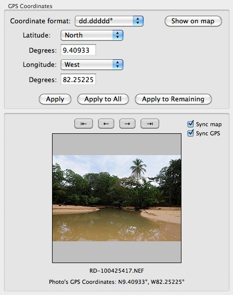
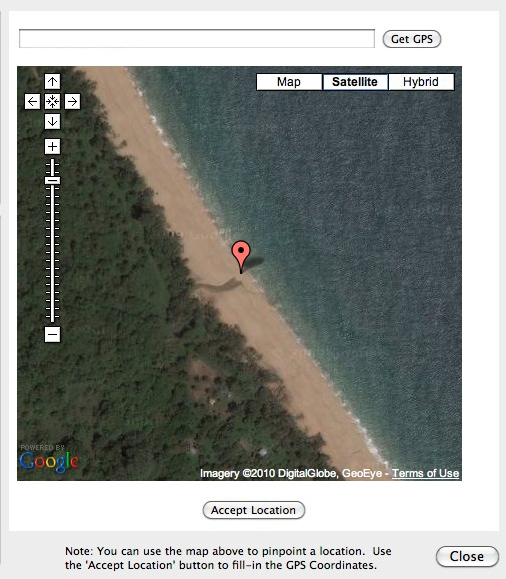
I’ve been using the GPS toolset in the latest version of PhotoMechanic, and it’s very easy to use. The GPS coordinates are read by PhotoMechanic from the image exif data and are then automatically fed to Google Maps by PhotoMechanic. Using Google Maps, PhotoMechanic shows an aerial view of the location where the shot was taken. This can be very useful to document the exact location where an image was taken, without (or in addition to) the use of paper notes. In Panama, this was terrific, as many of the locations that we went to were not well defined by name.
Here’s the left side of the GPS window from PhotoMechanic:

and the right side:
This location is Bluff Beach, Colon Island, Panama. Note the water coming across the beach on the arial view. This is a great way to confirm or determine where shots were taken. It will be nice when the GPS functionality is built into the camera.
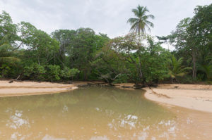
Here’s a low-res image if you want to download it to see the exif data:
You can download this image and use the Mac Preview application (or other Windows tools) to see the GPS data, as well as a Gooogle Map. You can even click on the map to zoom in!
If you don’t have a Mac and you don’t want to download software you can view the GPS metadata and the map live, online, using Jeffrey Friedl’s free exif viewer.
This beach is a nesting location for endangered Leatherback Sea Turtles, as well as a filming location for the Columbian version of the TV show Survivor, an issue of great controversy while we were there. Of course, as well as being a useful tool, geotagging also raises ethical issues regarding the public distribution of location data.
PhotoMechanic overall does a great job allowing GPS data to be read, inserted, or changed. I would like to see a tool for automatically filling in GPS data on images where it was not captured, using previous/next image data. You can do it manually, though, without much difficulty. As for Nikon’s GPS attachment, at least in Panama, it was often slow to pick up satellites and confirm a location (1-3 minutes at times, almost instantaneous at other times), and at times it dropped data in a shooting sequence.
In general, way cool.
Tags: geotagging, GPS


Qué tal gente,
Respecto a este artículo, me gustaría daros a conocer un proyecto que he realizado y que esta muy relacionado con este artículo.
whereisthepicture.com es un sitio en el que subes una foto y al cabo de unos segundos, si la fotografía contiene información gps, whereisthepicture.com te mostrará donde fue tomada la fotografía.
De lo contario, whereisthepicture.com da la posibilida de geoetiquetar la foto, y finalmente puedes enviar la fotografia reducida y geoetiquetada a tus amigos.
Es un proyecto aun algo verde, pero prometo ir añadiendo funcionalidades en los próximos meses.
un abrazo,
Paco Fernández
Hello,
Regarding this article, I would like to give you know a project I’ve done and that is closely related to this article.
whereisthepicture.com is a site where you upload a photo and after a few seconds, if the photograph contains GPS information, whereisthepicture.com will show you where the photo was taken.
In the contrary, whereisthepicture.com gives the possibility to geotag your photo, and then you can send small and geotagged photo with your friends.
It is a project still somewhat green, but I promise to be adding features in the coming months.
a hug
Paco Fernandez